Soknopaiou Nesos Project
Archaeological mission of the University of Salento (Italy)
Dime es-Seba
Exploring its past to preserve its future
The town of Soknopaiou Nesos was abandoned by its inhabitants around the middle of the 3rd century AD and was soon covered by the desert sand. Its buildings started to ruin and the collapse of their roofs and of the upper floors sealed and preserved, together with the sand, the objects that were left behind by the inhabitants. During the Late Roman and Byzantine periods, people continued to visit the site from time to time, and to live inside the temple area, as has been demonstrated by the objects found in recent archaeological excavations of the University of Salento (Lecce).
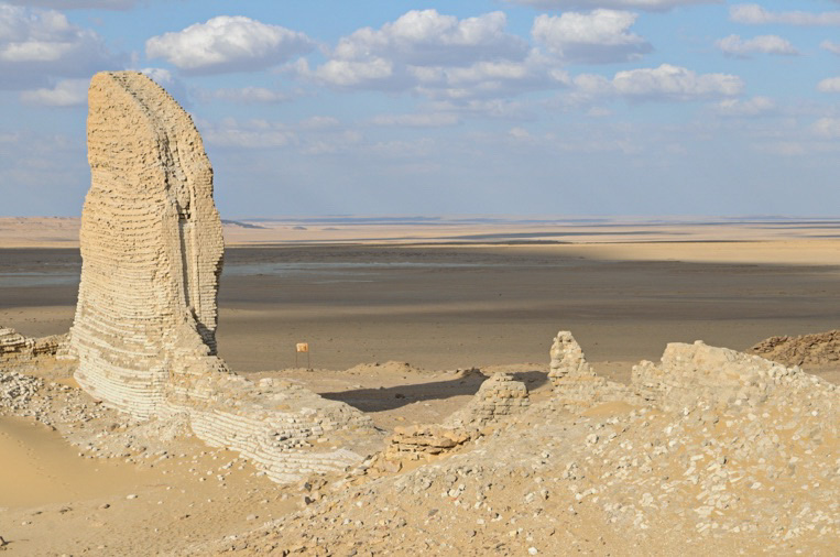
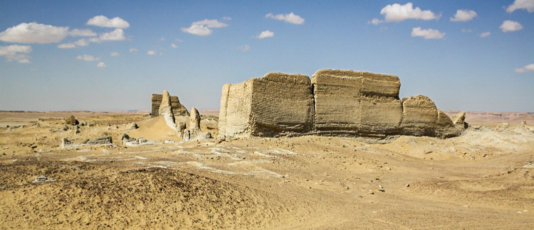
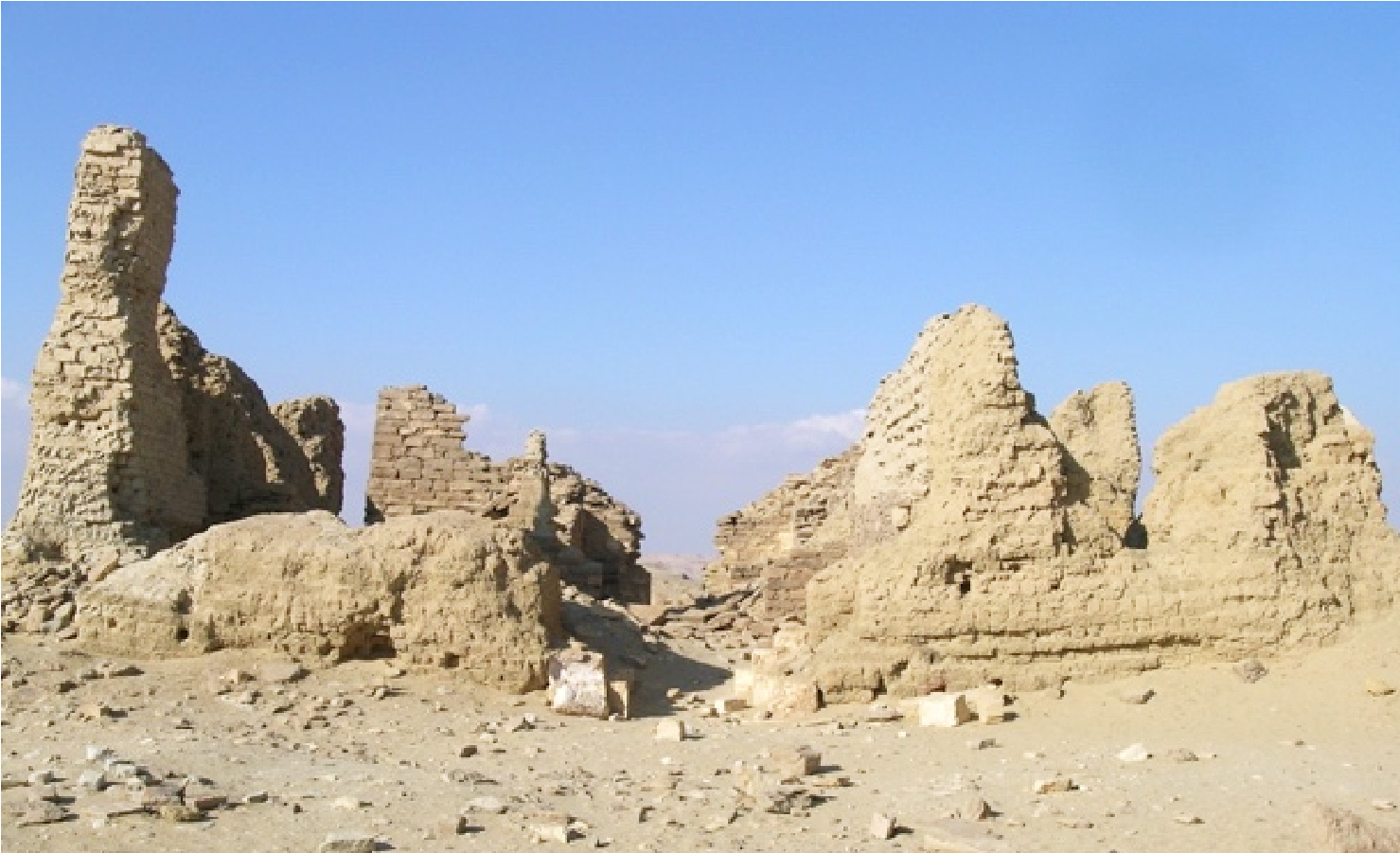
Thanks to the remoteness of the ruins from the settlements and cultivated fields of the Fayyum, the site did not undergo heavy destructions and it is still well preserved. Its remote location, however, did not prevent people to collect materials to be reused and to search for antiquities to be sold. The white walls of the temple area stand out against the sky for a height of 15 meters and are a secure marker point for desert travellers.
The settlement was founded in the 3rd century BC, at the beginning of the Ptolemaic period, during an impressive project of land reclamation carried out during the reign of Ptolemy II (282-246 BC). This project allowed the maximum extension of cultivable land in the Fayyum, one of the main fertile areas in Egypt. Hundreds of kilometres of artificial channels were dug in the desert surrounding the oasis to convey and drain water, and numerous settlements were founded for the new settlers. The newly acquired lands were distributed to foreign soldiers and officers recruited by the Ptolemies, rulers of Macedonian origin who inherited Egypt after the death of Alexander the Great. Fayyum continued to be a region with a high density of foreigner residents or owners of lands even during the Roman period. Among them there were veterans and relatives of the emperors.
Soknopaiou Nesos (“The island of the god Soknopaios”) is the Greek name of the town, set in the desert with an important temple and as a centre for commerce. The caravan routes connecting the western desert oases to Alexandria and the Mediterranean Sea passed through this site.
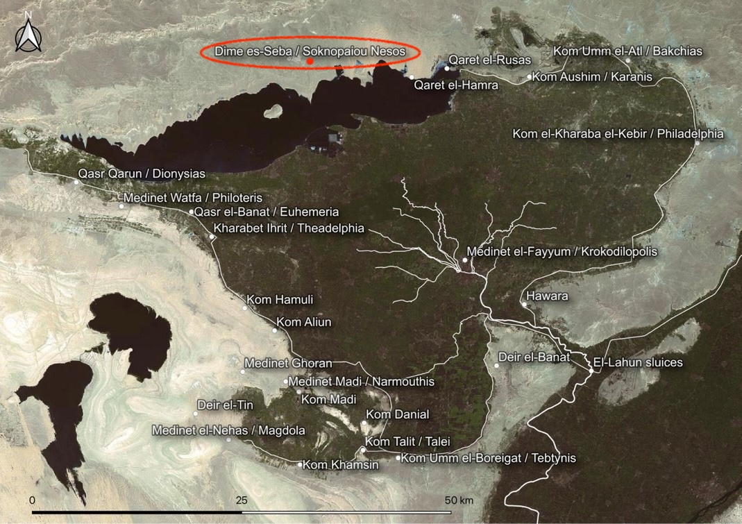
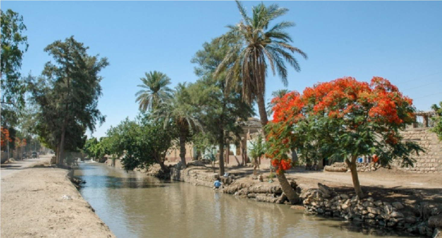
The oasis of the Fayyum lies in the desert about 80 km southwest of Cairo. The region (1900 km2) is a vast natural depression in the Libyan desert, supplied with Nile water through a natural canal called Bahr Yussuf. In Medieval times it was famous for the cultivation of roses, used in the production of perfumes, while in the Roman period it was considered the granary of Egypt and of Rome. The grain was transferred to Alexandria through navigable canals and then to Rome. Nowadays the most widespread crops are olives trees, dates, cotton, sugar cane, grapevine, and several different kinds of fruits and vegetables.
A canal in Fayyum
Birket Qarun, nowadays a salty lake, lies in the deepest area of the depression. In some periods in the past, it occupied the whole region. Its present level (its shores are at 45 m below sea level) is regulated by the sluices located at El-Lahun, at the mouth of the depression. Beginning with the Middle Kingdom, and even more during the Graeco-Roman period, the extension of the lake has been reduced thanks to an efficient hydraulic management, cultivations could extend, and population grow.
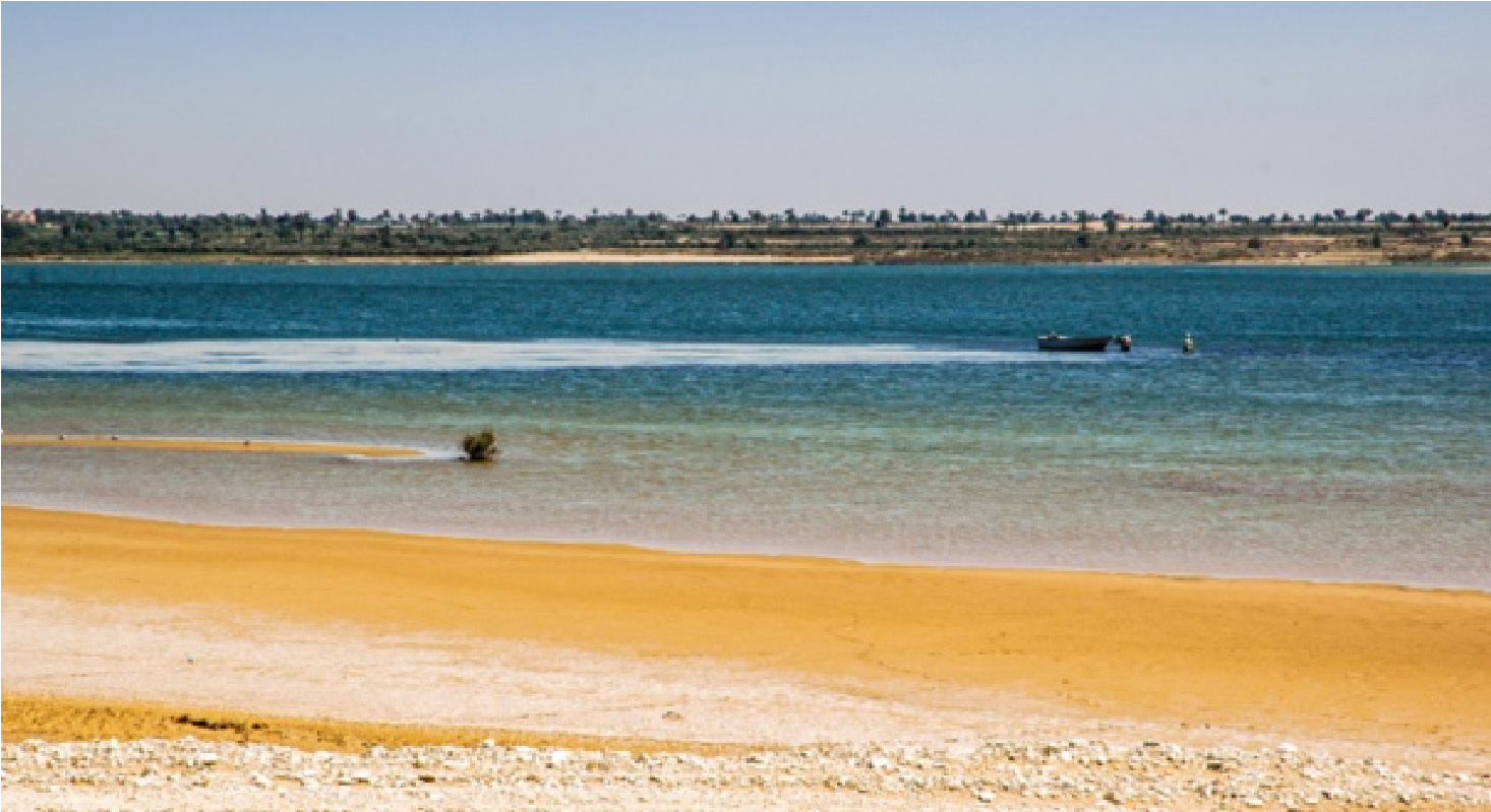
The Qarun lake
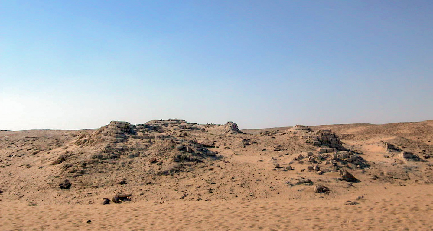
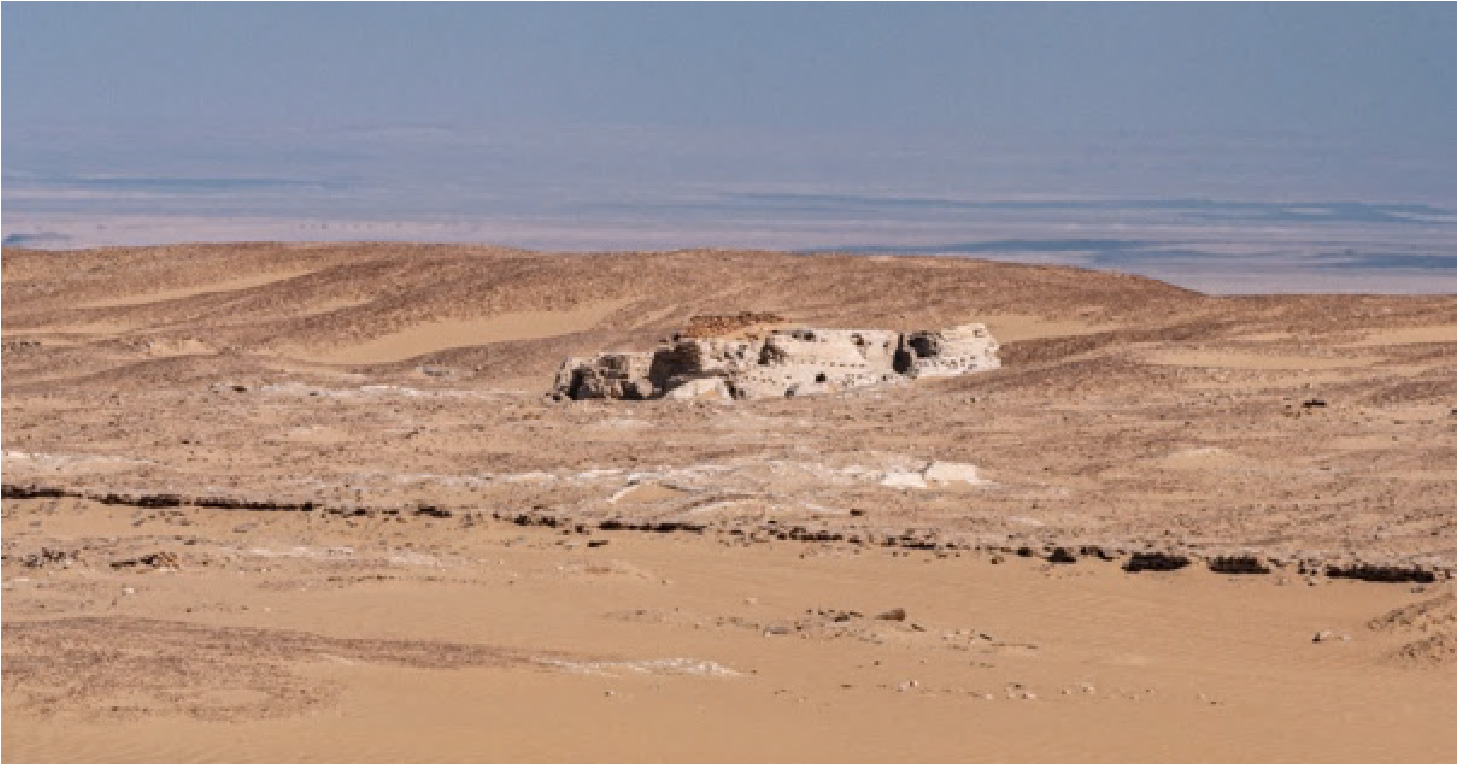
Very few are the preserved temples of the 12th dynasty in Egypt. Two of them are in the Fayyum, at Medinet Madi and Qasr el-Sagha. The latter is located in the desert north of Lake Qarun, at the foot of the Gebel Qatrani plateau, famous for its basalt quarries known since the Old Kingdom.
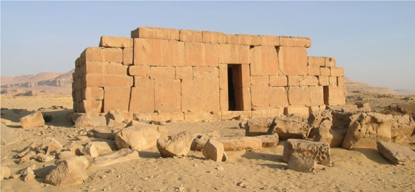
Qasr el-Sagha
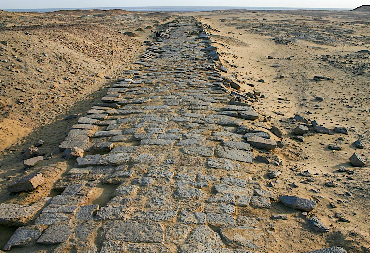
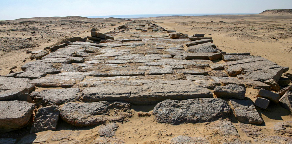
A paved road was built in the Old Kingdom to transfer the basalt blocks from the quarries to the ancient lake. It’s likely the most ancient paved road in history. The temple at Qasr el-Sagha was built in the late 12th dynasty, but the lack of decorations and inscriptions suggests that it has not been completed.
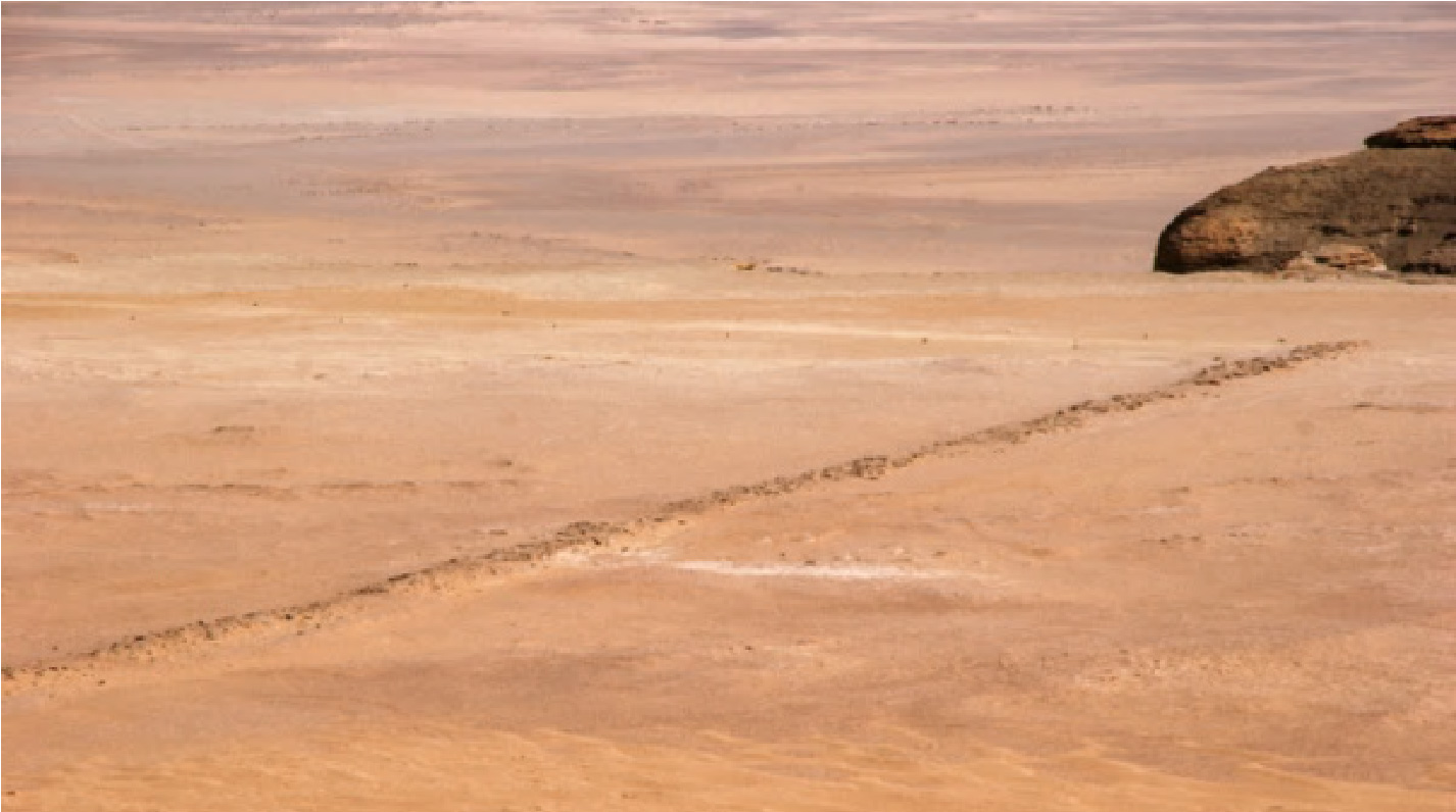
The road to the quarries
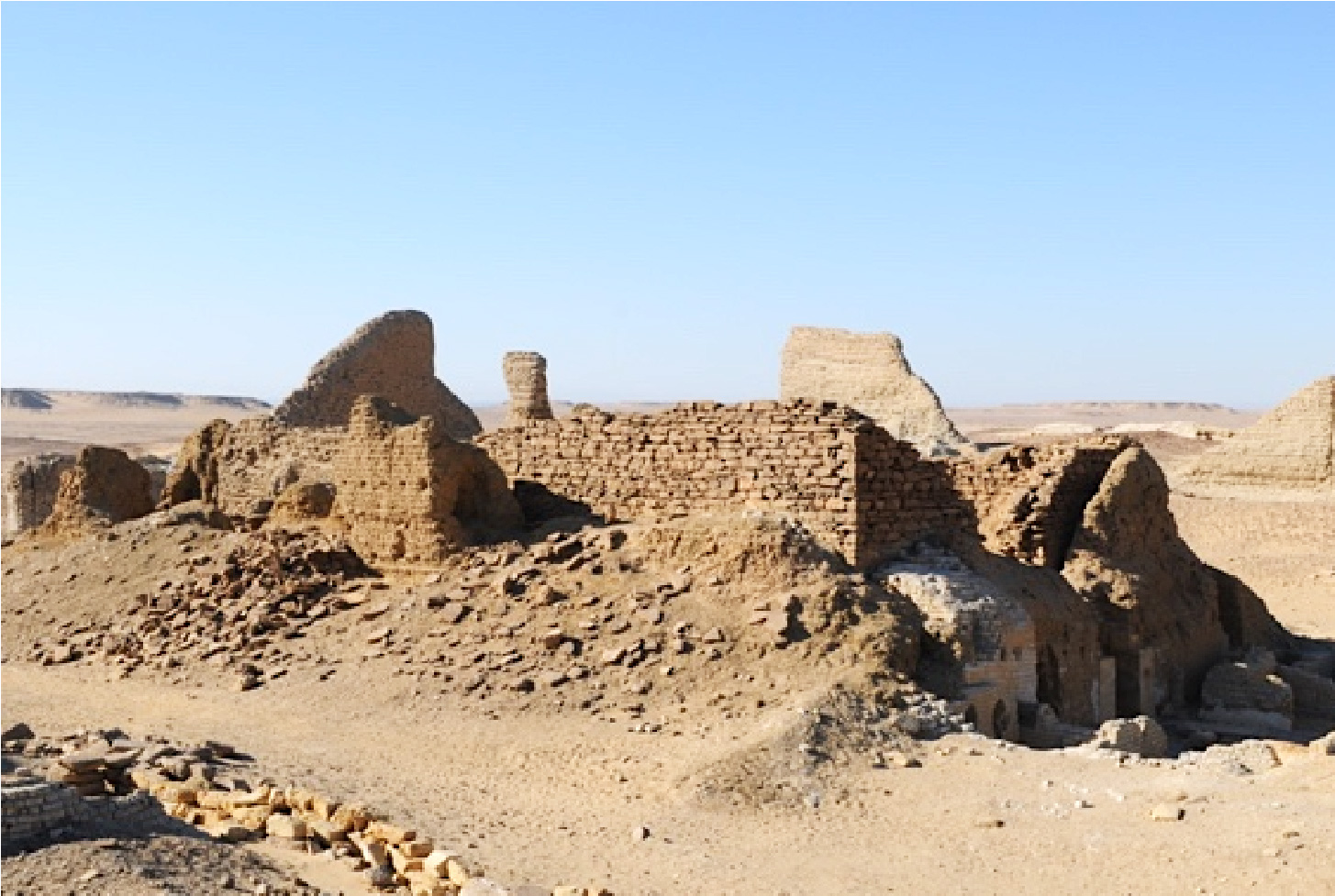
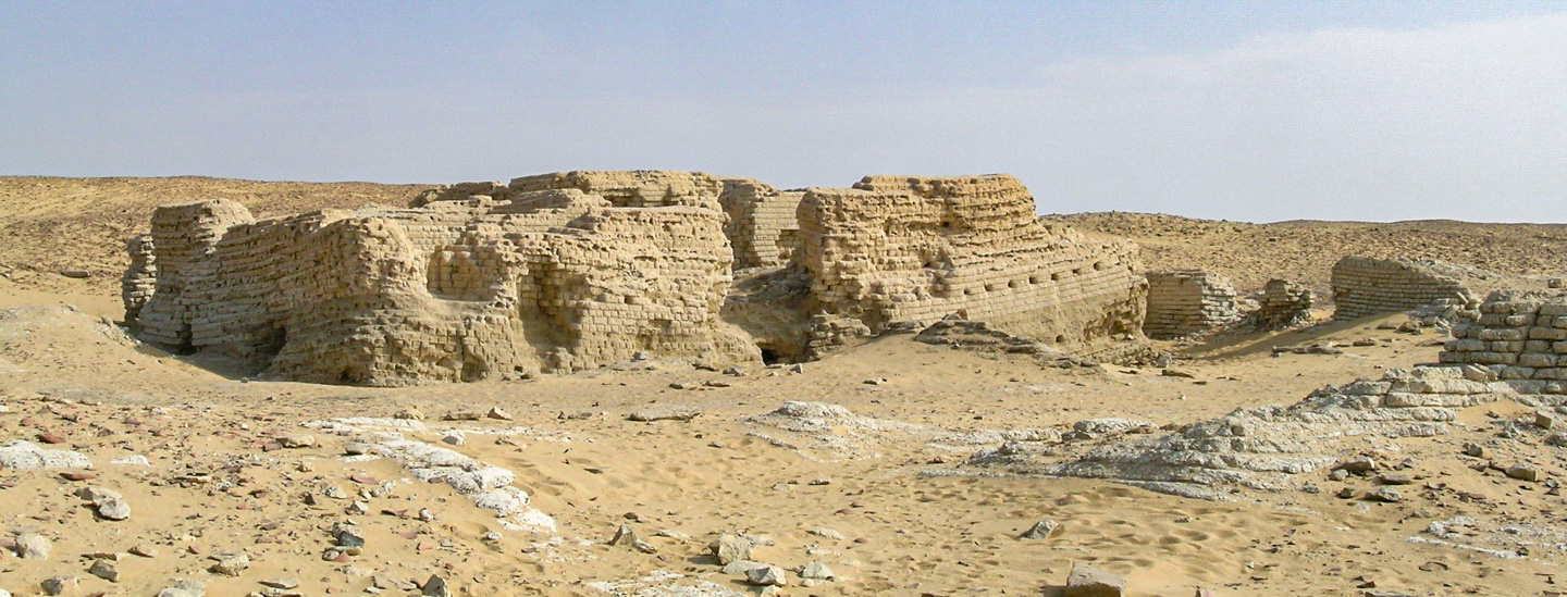
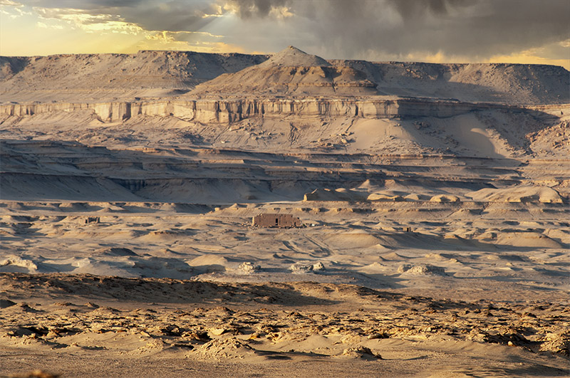
At present, the northern shore of the lake is deserted. This is the main reason for the good state of preservation of many ancient sites and cemeteries belonging to several periods of the Egyptian history located in this area. This area is under the protection of the Ministry of the Environment and is a natural park. One of the archaeological sites was already famous the 17th century for its monumentality and richness in objects and papyri: Dime es-Seba, in English “Dime of the lions”.
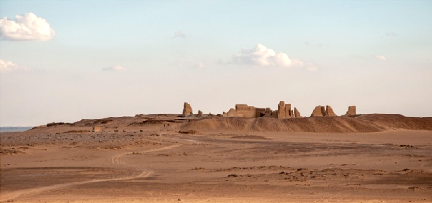
Dime from northeast
The settlement was founded in the 3rd century BC (at the beginning of the Ptolemaic period) and it was abandoned at the middle of the 3rd century AD (Roman period) for unknown reasons, probably related to water shortage. The ancient Greek name was Soknopaiou Nesos, the “Island of the god Soknopaios”. However, the town was not on an island during the Graeco-Roman period, thus the name probably refers to the fact that it was built on a hill in the flat desert, or maybe that its temple was founded on a hill that was considered as the representation of the primeval hill raised from the primeval ocean (Nun).
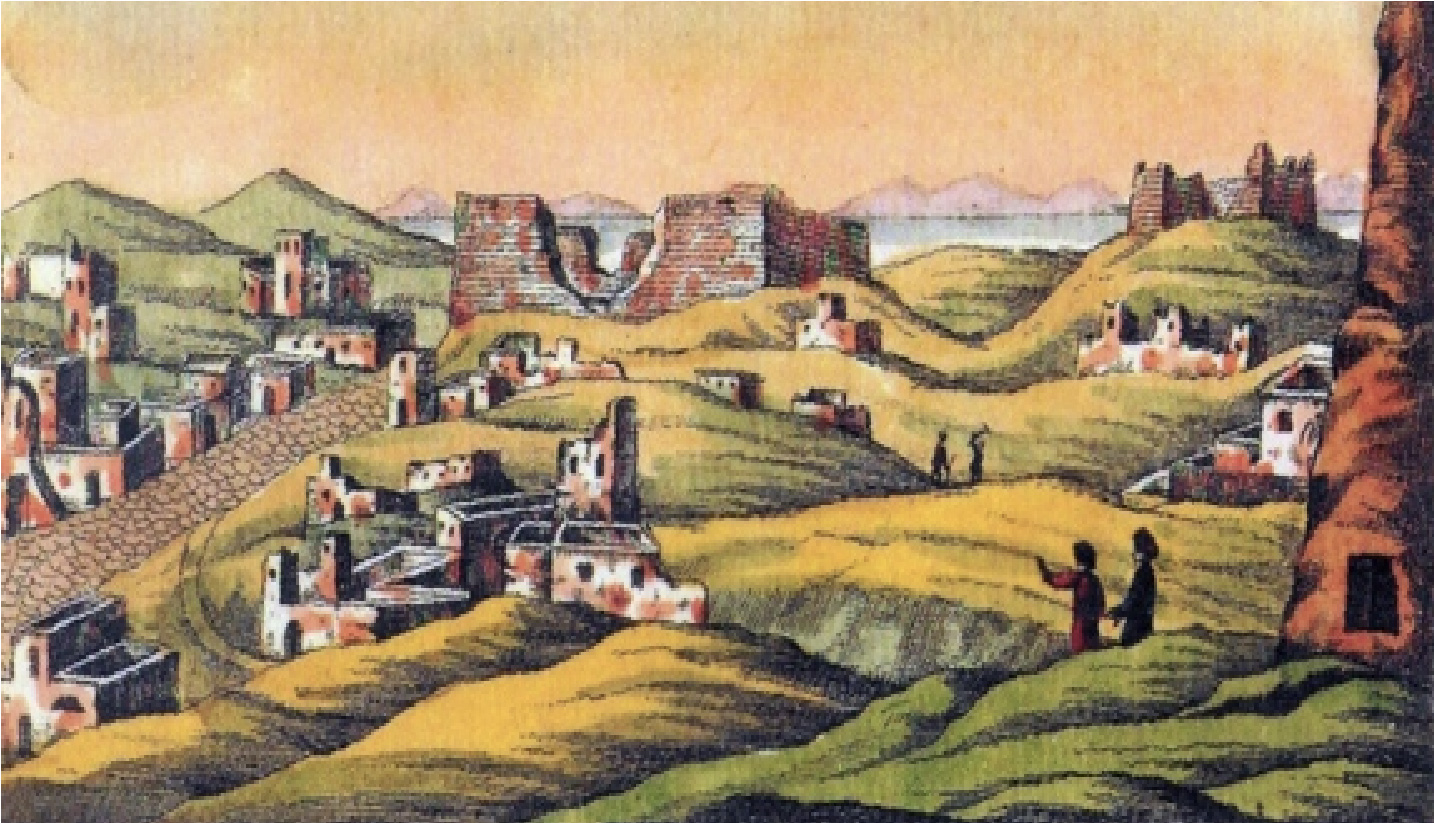
Painting by G.B. Belzoni, 1819
Giovanni Battista Belzoni, born in Padova, Italy, was one of the first modern travellers to reach Dime. He painted a watercolour during his visit in 1819. Houses and temples seem to have been in a better state of preservation than nowadays (see photos). Worth mentioning are the paved road, that divides into two parts the town, and the high walls of the temple. Numerous visitors, treasures and papyri hunters have dug in the ruins after Belzoni.
The only scientific archaeological excavation carried out in the site was that of the University of Michigan in the winter 1931-32. Two blocks of houses were brought to light; they were built in different periods resulting in several stratigraphic levels. The team discovered that the stratigraphy of the town is about 10 meters deep. The buildings visible on the surface are only the last ones to have been built in the 2nd-3rd century AD. Financial and logistic constraints (both due to the remote location of the ruins) forced the Michigan mission to stop the excavations after only three months.
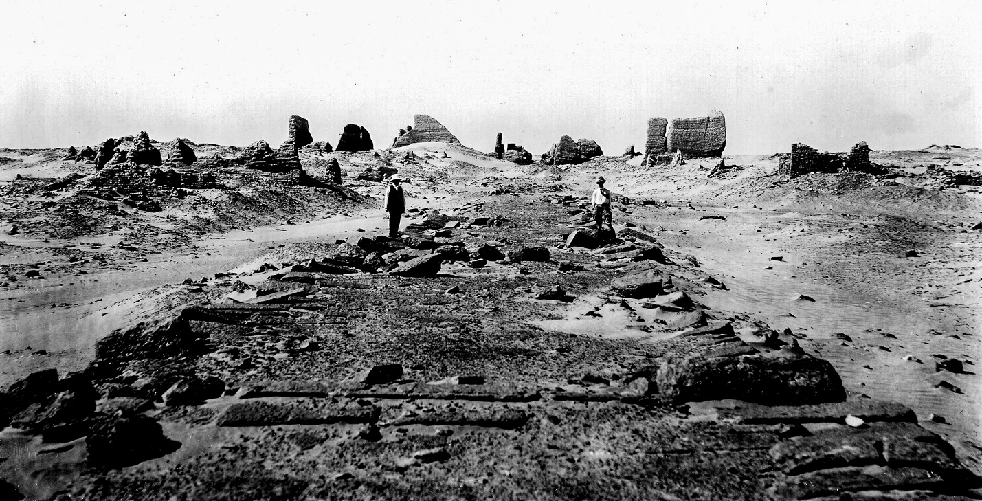
University of Michigan, 1920
(photo courtesy of Kelsey Museum, Ann Arbor)
Beginning from 2001 the University of Salento (Lecce) resumed the scientific archaeological research on the site. The Soknopaiou Nesos Project is a research project of the Centro di Studi Papirologici in collaboration with the chair of Egyptology, focused on the study of the Graeco-Roman town of Soknopaiou Nesos. The Project includes the archaeological excavation that began in 2003, the study of the thousands of documents in Greek and Demotic found in the past and during the new excavations, the organization of an archive of images, documents, and publications relating to it. The Project is directed by Paola Davoli, professor of Egyptology, and by Mario Capasso, professor of Papyrology, and is supported by the University of Salento, by the Italian Ministry of Foreign Affairs, by Cav. Luca Trombi, by the Centro di Studi Borgiani (Velletri), and by the friends of the Soknopaiou Nesos Project. The economic support of the private sponsors allowed the restoration of some important objects and the systematic survey of the area around the settlement. In 2021 an important grant from the Antiquities Endowment Fund of the American Research Centre in Cairo allowed to start working to the restoration and presentation of the temple area.
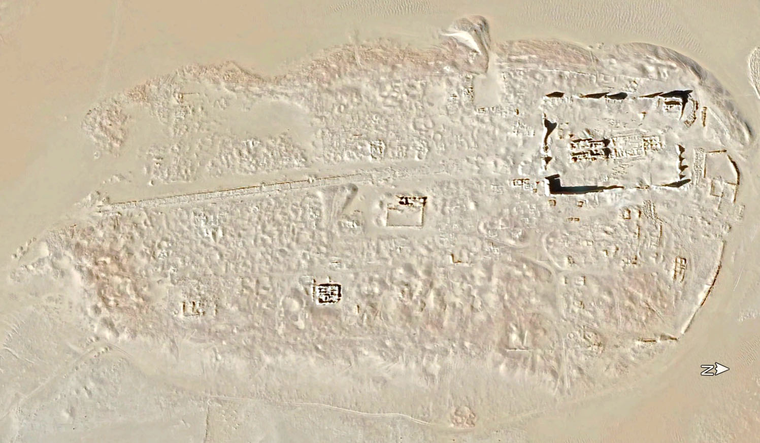
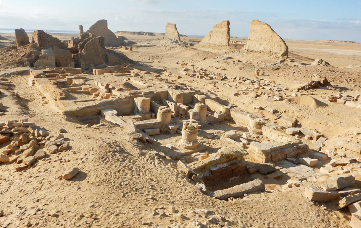
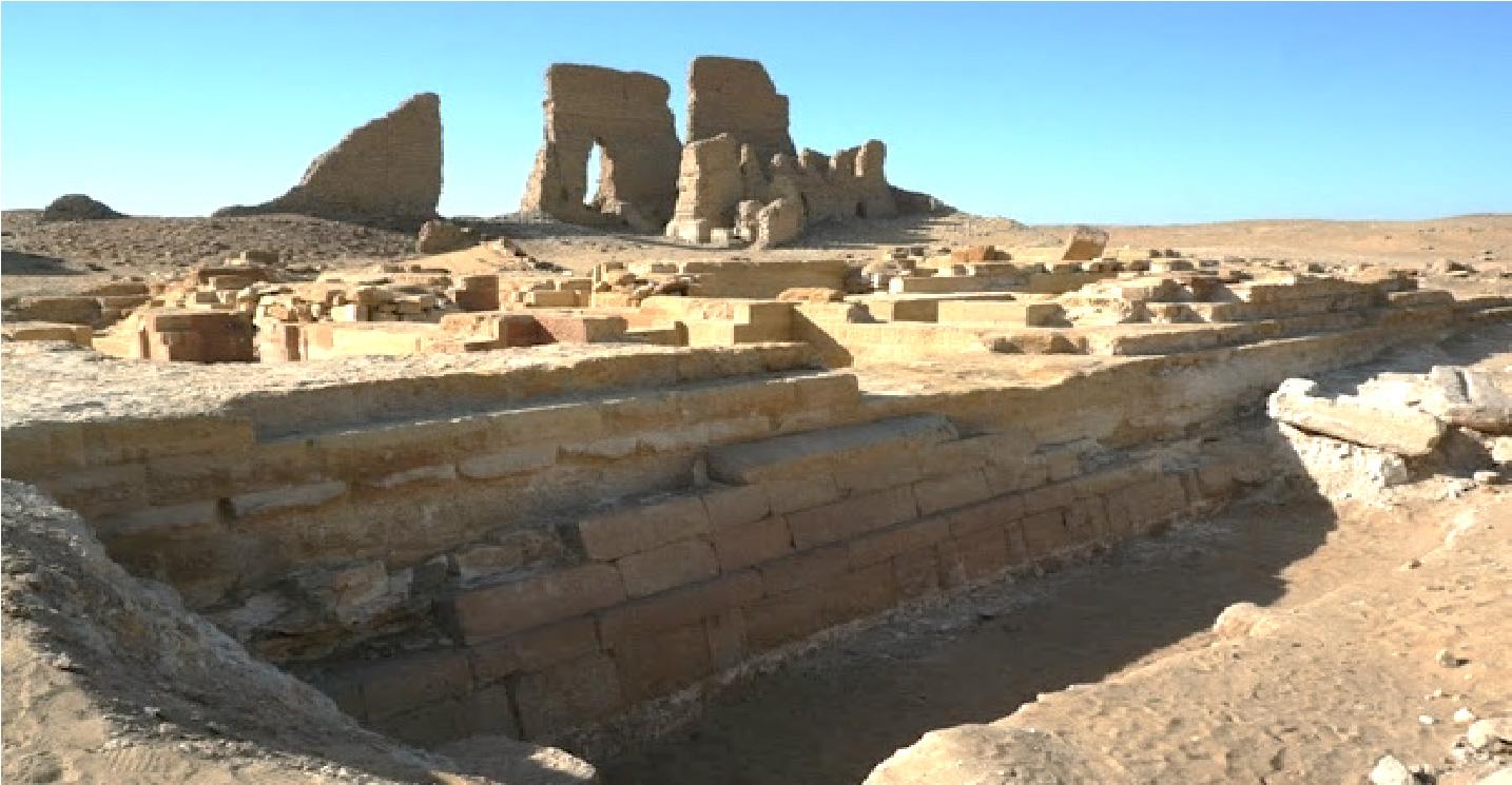
The ruins have an oval shape and extend over an area of 660 m x 350 m. It is a mound in the flat desert and its height is due to the fact that the settlement was originally placed on a hill and that the windblown sand continued to deposit forcing the raise of the floor levels.
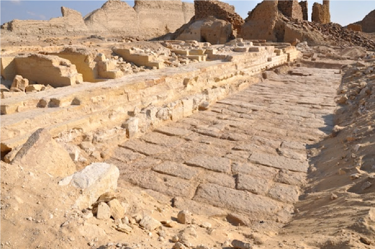
A layer of potsherds covers the entire surface of the site. The potsherds are the result of the ancient daily use of pottery vessels. Circular areas full of clean yellow sand are spread all over the site. They are pits excavated in the past by treasure hunters backfilled naturally by desert sand. The town is divided in two parts by an elevated paved road, the dromos, originally 400 m long and 3 m high.
It leads to the great temple of the god Soknopaios, protected by an impressive wall, and built on top of a hillock. In fact, the road follows a light slope from south to north. It is composed by two parallel walls in stones filled by sand on which the grey limestone slabs are placed. Two tunnels below the street allowed people to pass from one quarter to the other, and some staircases gave access to the paved road.
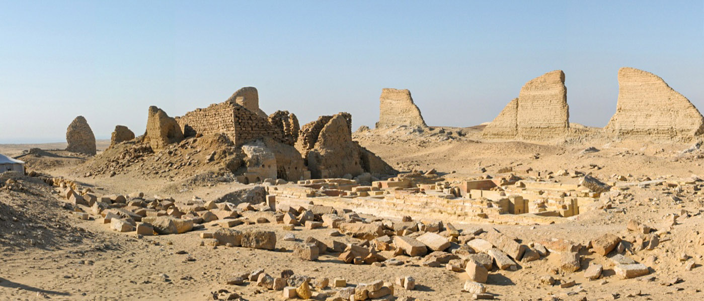
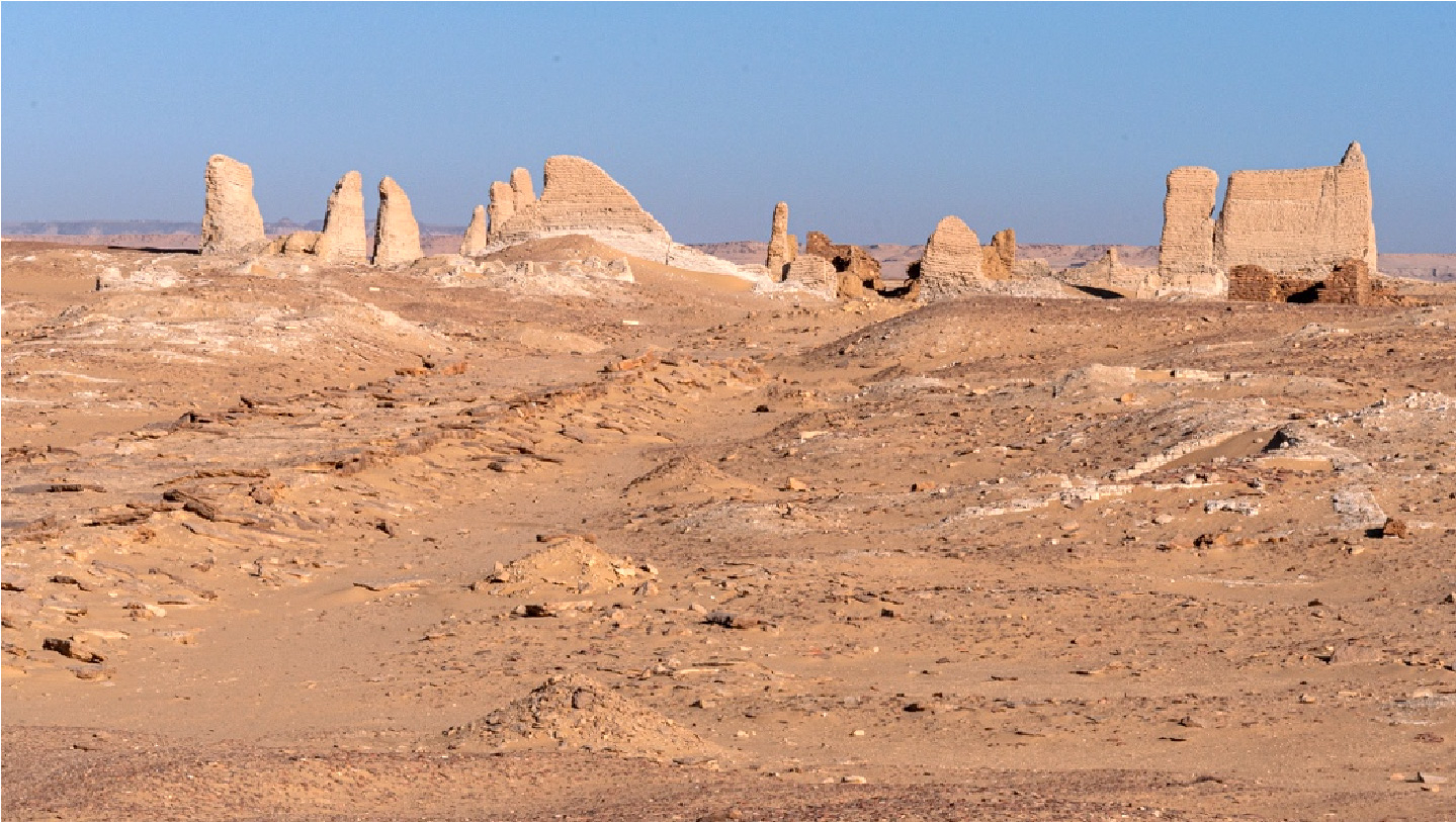
View of the temple area from northeast
Since some years the site has been easily accessible from Cairo by means of new road that connects the Cairo-Fayyum highway with the road to the Oases. The entrance to the North Qarun Lake Natural Park is from the east: an asphalted road connects the Oases highway to the western end of the lake and the region, thus allowing you to admire one of the most beautiful and interesting desert areas in Egypt, and to carry out the complete circumnavigation of lake Qarun. A well-marked track leads tourists to the north end of Dime. A small modern building on the north side of the ruins houses the guardians of the archaeological area. It is recommended to park close to this building and out of the archaeological site to avoid damaging the ruins. The visit will proceed from north to south, passing through the temple and then walking on the paved road (dromos).
A guided visit to the site
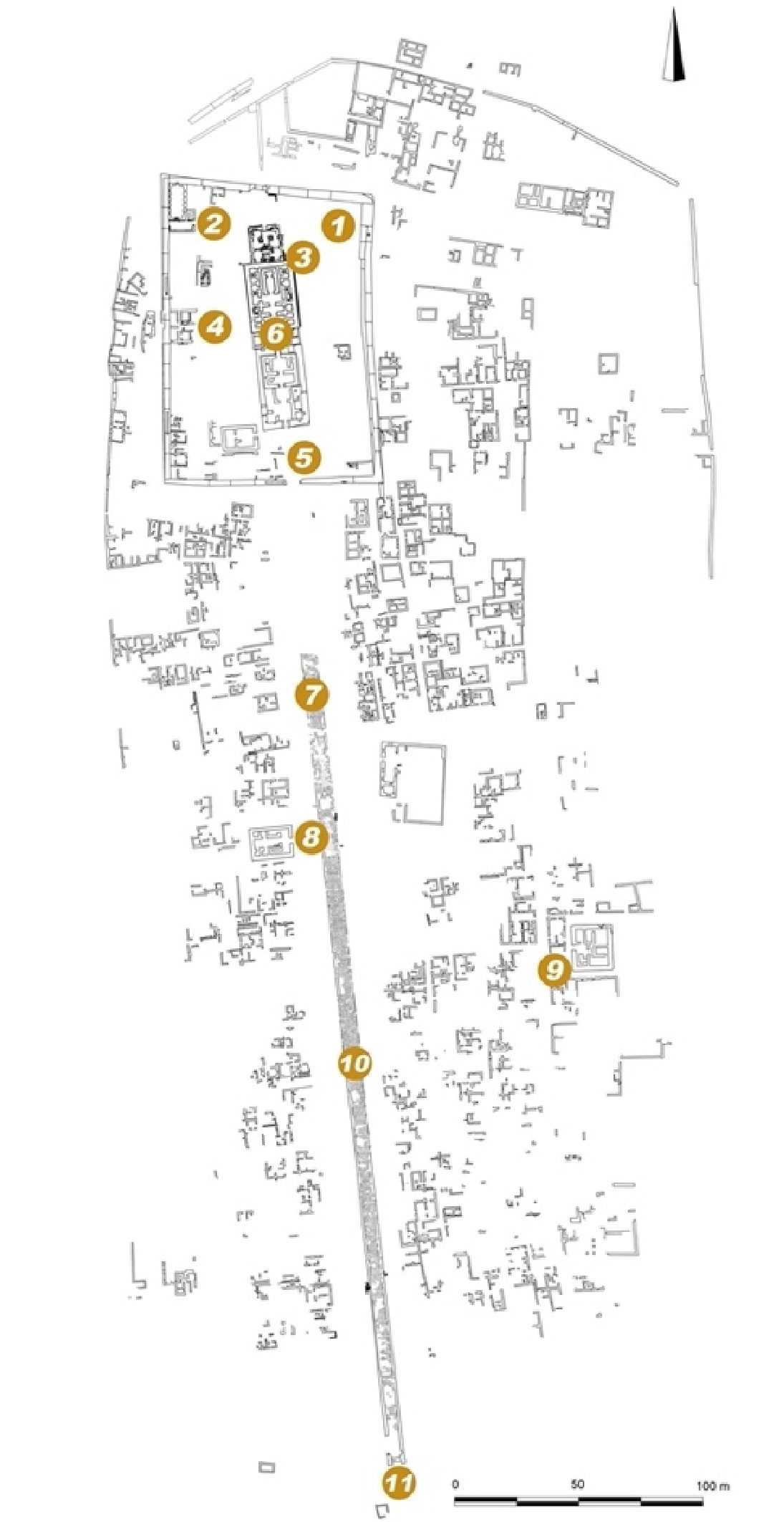
Spot 1: the temenos (map)
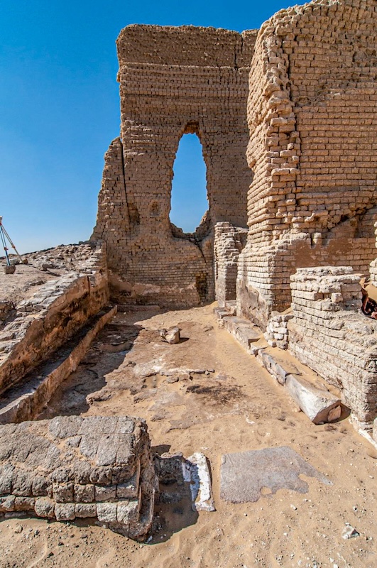
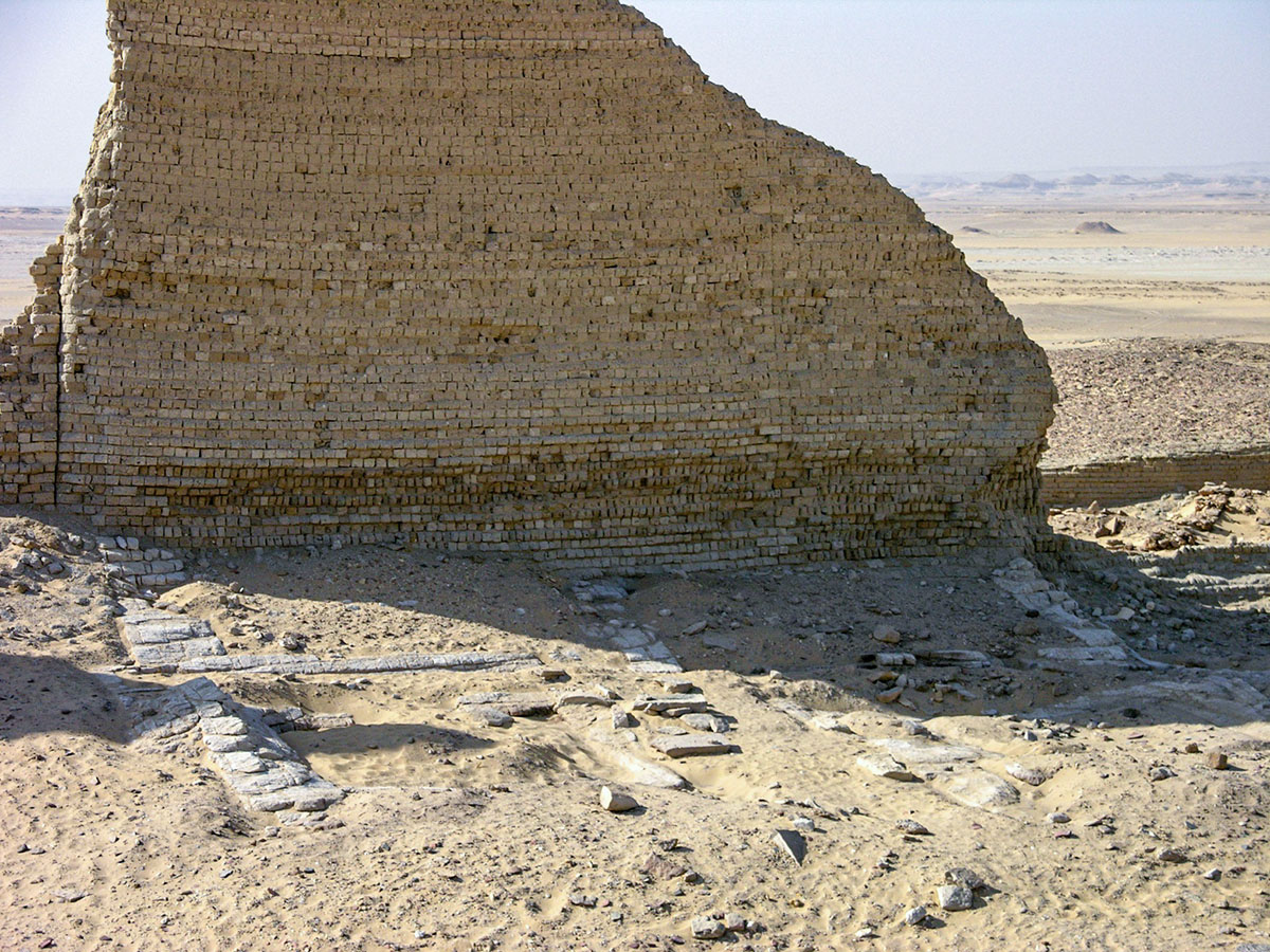
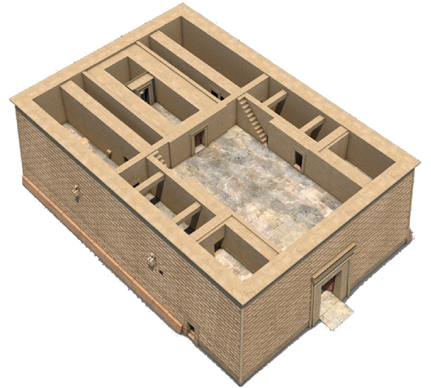
The temple of Soknopaios is protected by high walls (temenos) built with mud bricks following an effective building technique that allowed its fairly good state of preservation. The walls were built in several sectors, so that the collapse of one of them wouldn’t have determined the collapse of the whole. The temenos is about 124 x 88 m and is preserved up to a height of 15 m. The Dime temple area is the best preserved in the Fayyum: inside the precinct are still visible temples, priests’ houses, and other buildings quite well preserved (spots 2 and 4). The main temple dedicated to the crocodile god Soknopaios, to the goddess Isis Nepherses and to the god Soknopiais, is in the middle of the area. The sanctuary is composed of two buildings built with different materials and in two subsequent periods. The most ancient is the smallest one (spot 5) and was probably built at the beginning of the Ptolemaic period (3rd century BC). Afterward the temple was enlarged with the addition of a second structure in yellow limestone blocks (spot 6). Between the two buildings there is a paved courtyard with two auxiliary structures in mud bricks. To follow a correct visit (like that of the ancient priests) you should walk from south to north and pass through the gateways on the main longitudinal axis of the temple.
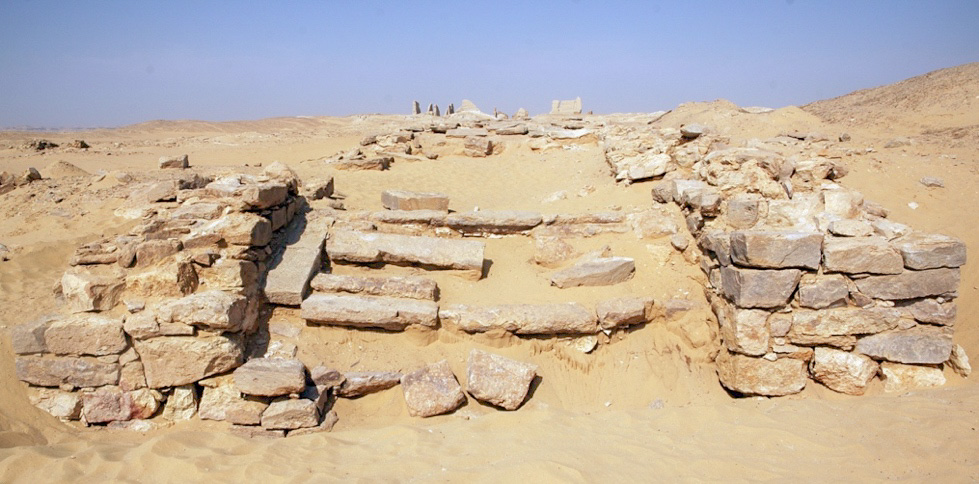
Spot 2: religious building (map)
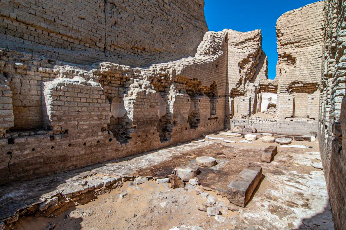
The building consists of three rooms and a partially visible staircase, made of mud bricks. The walls of the largest room are preserved up to a height of 8 meters. It is characterized by the presence of 15 niches, plastered with white plaster mortar. On the east side 5 windows are still partially preserved on top of the niches.
The niches were decorated with limestone architectural elements that made up small chapels. There were also stone blocks resting on the floor that formed benches and a row of reused column drums embedded in the floor on the central axis. The room was furnished with wooden beds and chairs with pillows and mattresses, altars of various shapes and was decorated with garlands made up of flowers, bells, pinecones, and beads. Fragments of painted wooden tablets were also found, which belonged to paintings depicting divinities in classical style.
The second room of the building is smaller and, unlike the previous one, is oriented east-west. Only the threshold remains of the access door; a 40 cm wide stone block bench runs along the perimeter walls. Inside the room, fragments of Greek papyri and a gilded stucco decoration depicting the god Sobek and a fe male offering figure were found. Of particular importance is the discovery of a small basalt statue depicting Aphrodite.
The presence of benches in this room, cushions, and beds in the main room, together with materials associated with the cult, suggest that the building was used by the priests of the temple for ritual meetings.
Spot 3: the contra-temple (map)
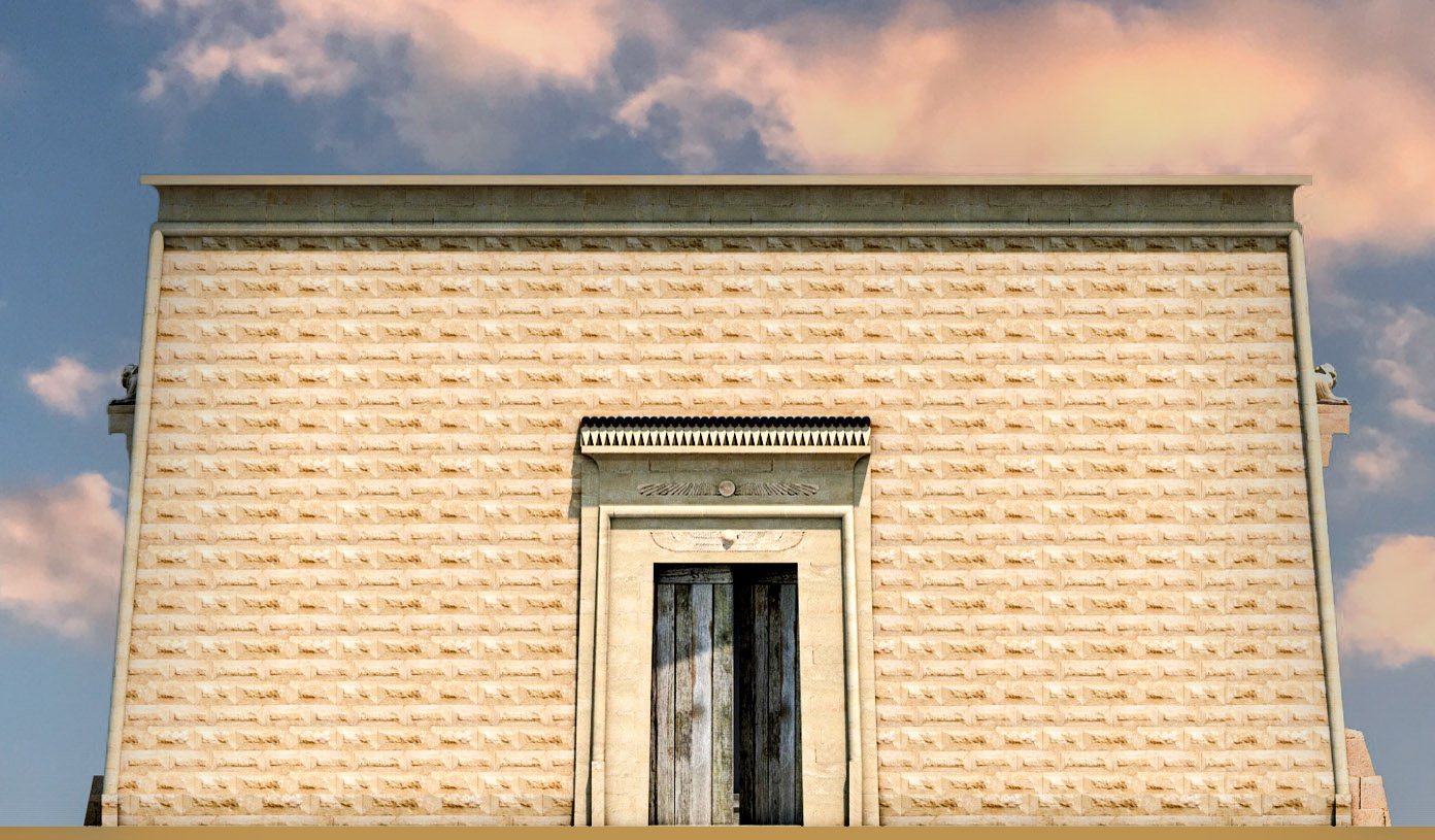
The contra-temple, built during the first century AD with yellow limestone blocks, is placed behind the Soknopaios temple and on the same axis. Its shape is similar to that of a kiosk with the addition of a roof and a hypostyle room. Although today it is preserved to a height of 2 meters, the restorations and changes to the original project made in the second century AD, a phase of major renovation throughout the sanctuary, are recognizable. The building had a large entrance hall with two columns; the southern half, on the other hand, was divided into 3 rooms. In the central area there was a limestone and basalt chapel of which it was possible to propose a 3D reconstruction. Access to the contra-temple was allowed to the people who could directly address their prayers to the god.
Virtual reconstruction of the contra-temple
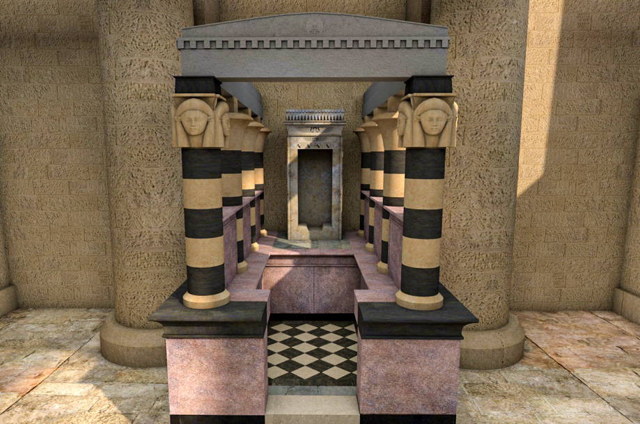
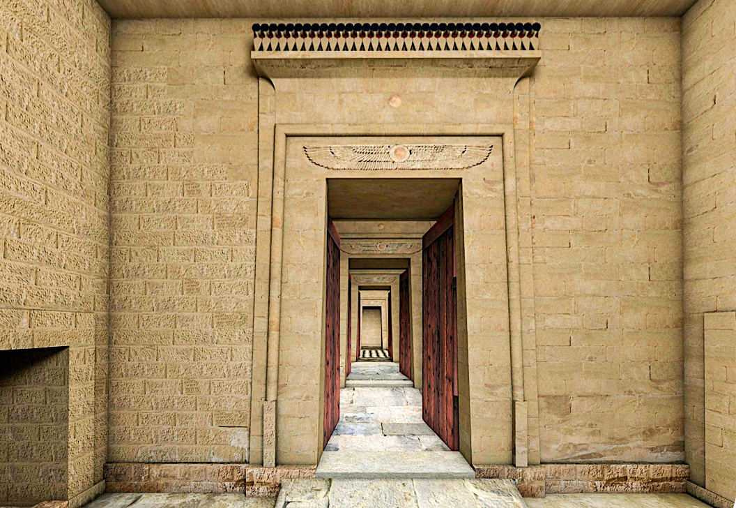
Virtual reconstruction of the interior
Inside the contra-temple a three-dimensional architectural model of the building was found. The limestone model faithfully reproduces the temple on a scale of 1:12 and is made up of numerous parts, from the base to the ceiling. The perimeter intercolumnar walls, the columns, connected to the bases with wooden tenons, the composite capitals, formed by three orders of superimposed flowers, are all well reproduced. The model must have been used as a building project and a construction reference. The model was kept inside the building, perhaps as a votive gift.
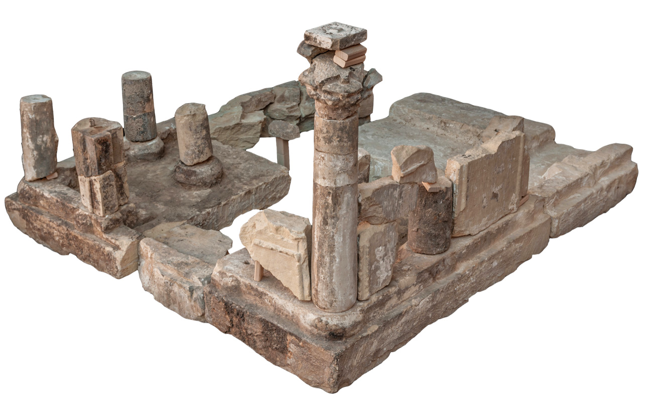
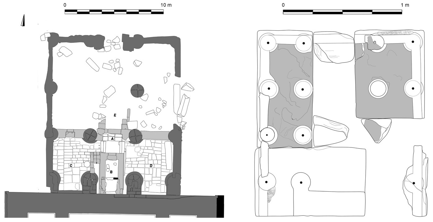
Plan of the contra-temple (left) and the model (right)
Spot 4: the priests’ houses (map)
Along the temenos walls there were numerous houses for the priests and other people who worked in the temple. Their ruins are well visible on the west side.
Spot 5: the temple of Soknopaios (map)
The main entrance to the older temple of Soknopaios is on its south side. The gateway was built with limestone blocks, at present only partially preserved. After the first door there is a series of rooms partially filled with collapses from the walls and the roofs. Originally the temple was plastered with a thick layer of painted plaster, of which only patches are preserved in some rooms. A staircase led to a second floor and probably to the flat roof. The last central room was the sanctuary, where the statue of the god rested. The temple is dated to the Ptolemaic period (3rd cent. BC) and was transformed during the Roman period in a monumental gateway for the new sanctuary built to the north of it (spot 6).
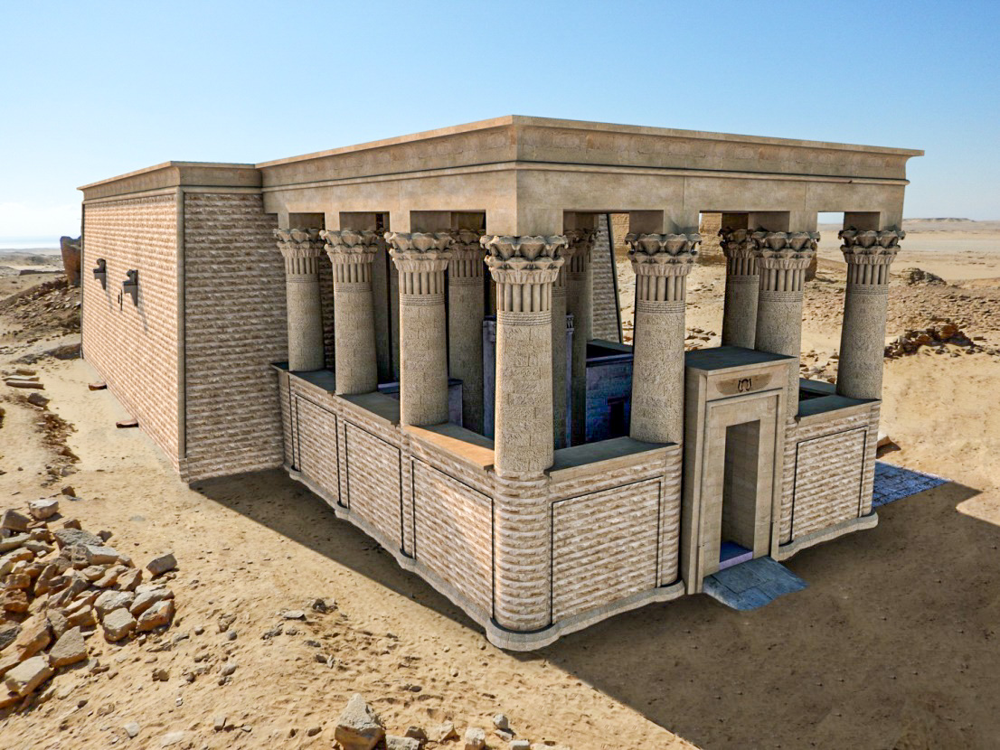
Spot 6: the temple (map)
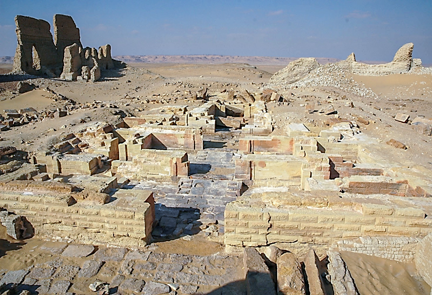
The yellow limestone block temple was built to enlarge the old sanctuary between the 1st century BC and 1st century AD. The names of the rulers who built it are unknown so far, but a king and a queen are represented on a bas-relief found in 2007 and then transferred to the general storehouse of the Supreme Council of Antiquities. The decoration of the temple was not finished.
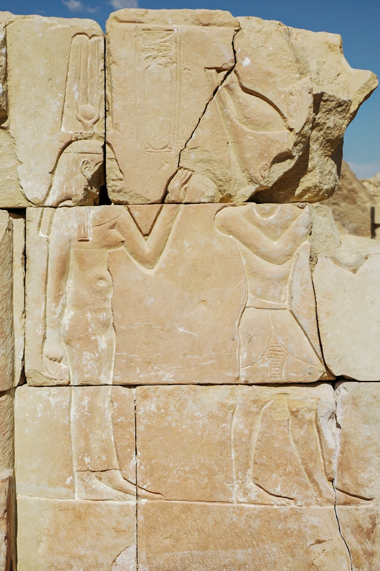
Bas-relief with images of sovereigns (now removed)
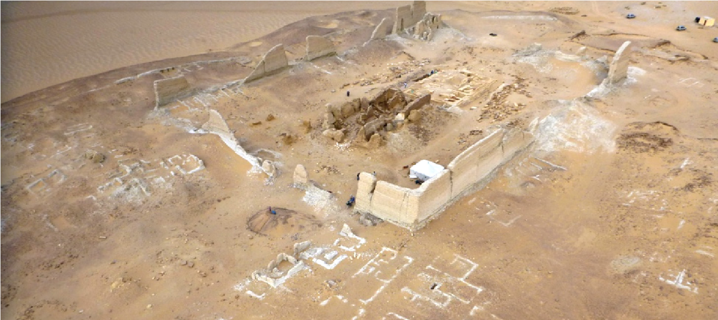
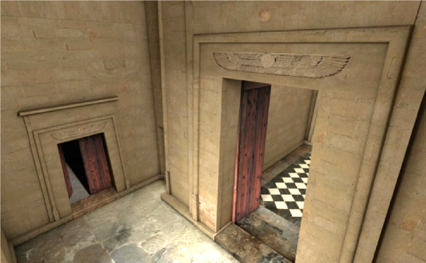
The new building (19.40 x 25 m) has been partially demolished in Late Antique and Byzantine periods to reuse the blocks in new constructions. However, what was left is enough to allow a virtual reconstruction of the temple. It had two entrances, the main one from the south and the other from the west. The presence of two staircases suggests that there were at least two storeys. In 2007 some chapels and subterranean crypts has been found, but they were already plundered by previous diggers. The first central hall was called in Egyptian wesekhet. A short ramp introduces to the offering room, in which the king and the priests presented the offerings on altars in front of the gods. Passing on the third central room is the vestibule in front of the naos, the most sacred place where the statue of the god was housed. This temple has been discovered and studied for the first time by the mission of the University of Salento.
West side of the temple
The archaeological investigations carried out in the last years have brought to light the entire temple. Several ancient restorations, mainly to repair the erosion at the base of the external walls, have been recognized. In fact, two different facings were built at the base of the west and east sidewalls, covering eroded and damaged parts of the walls. In addition, in the second century AD, a limestone pavement was built outside the temple. The floor is perfectly preserved on its west side; on the contrary, on the eastern side it has been completely removed during the destruction phases of the temple.
East side of the temple
Below are some views of the virtual reconstruction of the temple of Soknopaios carried out on a scientific basis and on what is preserved of the building. The fully preserved temple of Qasr Qarun in Fayyum was taken as a model being very similar in style, plan and size to what remains of the temple of Dime.
Spot 7: the dromos (map)
Dromos is the Greek word for the processional way of a temple. It is a feature proper of the Egyptian temples through which they extended into the settlements. During the feasts the processions passed on this monumental way. The statue of the god (or a mummy in the case of the sacred crocodile) was transported on a stretcher by the priests. During these feasts people crowded together along the sides of the dromos and could “see” the god. The dromos was built 3 m higher than the common use streets. Several feasts were celebrated at Soknopaiou Nesos during the year, of which the most important were the birthday of Soknopaios and Isis Nepherses, which lasted for 19 days each, and the feast of the Roses of 13 days. Sphinxes or statues representing lions, stelae, private statues and sometimes trees were often placed on both sides of the dromos.
Walking on the dromos towards south you will find on your right a ruined mud brick building of dark grey colour.
Spot 8: a mud brick temple (map)
This building has been identified as a temple during the survey of the settlement. Unfortunately, the building is in poor condition, but its plan is well recognisable as that of a small temple. Papyri attest to the presence of many gods and goddesses worshipped in Soknopaiou Nesos, like Isis Esenchebis, Isis Nefremmis, Isis Sonona, Harpocrates, Harpsenesis, Pakysis, Premarres, Suchos and Thoth-Hermes. At present we do not have any evidence that can suggest to which one of these gods the temple was dedicated. New data can possibly be gained by means of future excavations.
Spot 9: houses (map)
East and west of the dromos are blocks of houses. The buildings visible on the surface belong to the Roman period and are set in blocks along streets parallel or orthogonal to the dromos. East of the dromos a big building in light grey mud bricks was a rich house brought to light by the University of Michigan in 1932. It is fairly well preserved, but in the last years all the decoration of the walls in the reception room, made in wood, has been removed and several damages to walls and floors were made by treasures’ hunters. The house developed on more than one storey. At present you can visit the first floor and the underground cellars covered by barrel vaults and by an impressive dome.
Spot 10: platform on the dromos (map)
A platform is situated at about middle length of the dromos. It is slightly larger and higher than the pavement. A step and five drums of columns mark the place. Kiosks with columns were common buildings on processional ways, used as stations for the procession of the gods. These scanty remains may suggest the presence of a kiosk, of which columns and walls have been dismantled
Spot 11: stairway to the dromos (map)
A monumental stairway gave access to the dromos from its south end. At present the preserved steps are just a few. Still, we do not know if and how the dromos continued toward the lake or the cemeteries. People living at Soknopaiou Nesos moved frequently to the other side of the lake to cultivate fields and to buy food and objects. The lake was the main way for these trips and thus it is possible that a road or a track connected the town with the lake.
During eighteen seasons of excavations the mission of University of Salento has found numerous statues, architectural elements, objects, documents, and monuments of high scientific value, despite the destruction of the temple and the repeated illegal digs in it. Their study is particularly relevant to the comprehension of the religious culture and of the daily life habits of the ancient inhabitants of Soknopaiou Nesos.
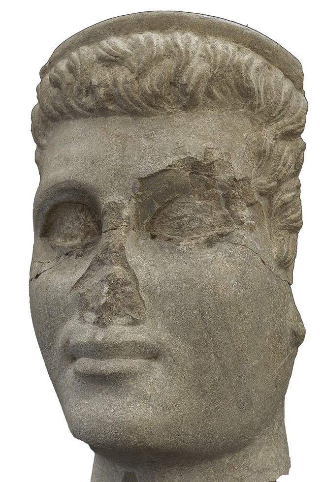
Head of a Ptolemaic king
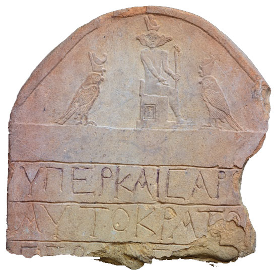
Stela with the god Soknopaios with falcon and crocodile heads on the two sides of the human face. Greek dedicatory inscription (Roman period)
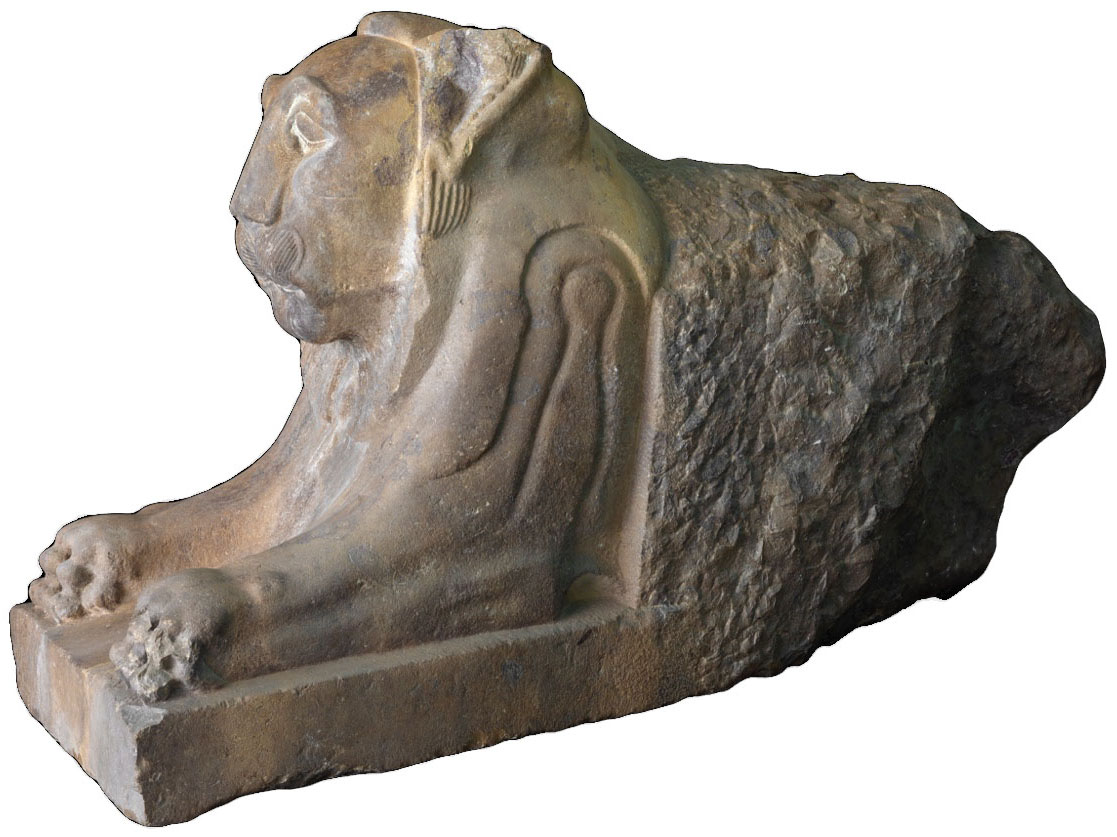
Lion sculpture that decorated a temple gutter
Decorative elements of a niche of the religious building (spot 2)
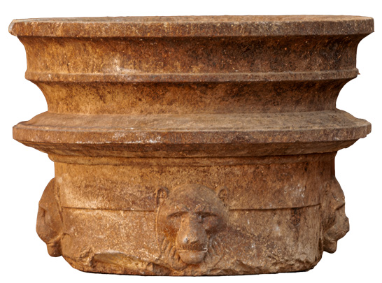
Circular altar decorated with four lion heads, from the same religious building
The Qarun Lake National Park
Since 2019 Dime and the desert north of Lake Qarun have been included in a Natural Park. The archaeological and natural landscape are a precious cultural heritage that must be protected. For this reason, it is firmly recommended to respect the archaeological area of Dime during the visit, in order to avoid any damage. We would like to remind you that it is absolutely forbidden and punishable by the Egyptian Law to climb and to ride with cars on the ruins, to excavate or pick up objects.
We invite the visitors to kindly keep clean the archaeological site and the surrounding desert. It is a heritage from the Antiquity that we must respect and protect for future generations.
Prof. Paola Davoli
Professor of Egyptology at Salento University. She is co-director of the Soknopaiou Nesos Project and Archaeological Director of the Archaeological Mission of ISAW (New York University) at Amheida (Dakheleh oasis), directed by prof. R.S. Bagnall, from 2005 to 2021. She published five books and many scientific articles.
Prof. Mario Capasso †
Professor Emeritus of Papyrology at the University of Salento. He founded the Centro di Studi Papirologici, and the Papyrological Museum; he was president of the Italian Association of Classical Culture and co-director of the Soknopaiou Nesos Project until 2022. He directed 17 papyrus restoration campaigns at the Egyptian Museum in Cairo and 3 campaigns for papyrus at Ain Shams University (Cairo). He is the author of three papyrology textbooks, numerous monographs and scientific articles.
Acknowledgements
The Archaeological Mission of the University of Salento (Lecce) would like to acknowledge institutions and people for their contribution to the Soknopaiou Nesos Project. A special mention is due to the Dean of the University of Salento, the Italian Ministry of Foreign Affairs, the Italian Cultural Centre in Cairo, the Andrew Mellon Foundation and Prof. Roger S. Bagnall. We are deeply grateful to the Supreme Council of Antiquities, to the General and local directors who have succeeded in these important charges, and to the inspectors who every year collaborated with the Mission.
Our warmest thanks are due to cav. Luca Trombi, to the Friends of Soknopaiou Nesos Project and to Centro Internazionale di Studi Borgiani of Velletri, directed by dr. Rigel Langella: without their support many activities wouldn’t have been possible. Finally, we would like to thank the Kelsey Museum of Ann Arbor (Michigan) to have kindly allowed us to publish some of their photographs.
Since 2021, the Soknopaiou Nesos Project has benefited from significant funding from the Antiquities Endowment Fund of the American Research Center in Cairo, which allows the restoration of some buildings and the presentation of the archaeological area for better comprehension by visitors. This guide was made possible thanks to this funding.
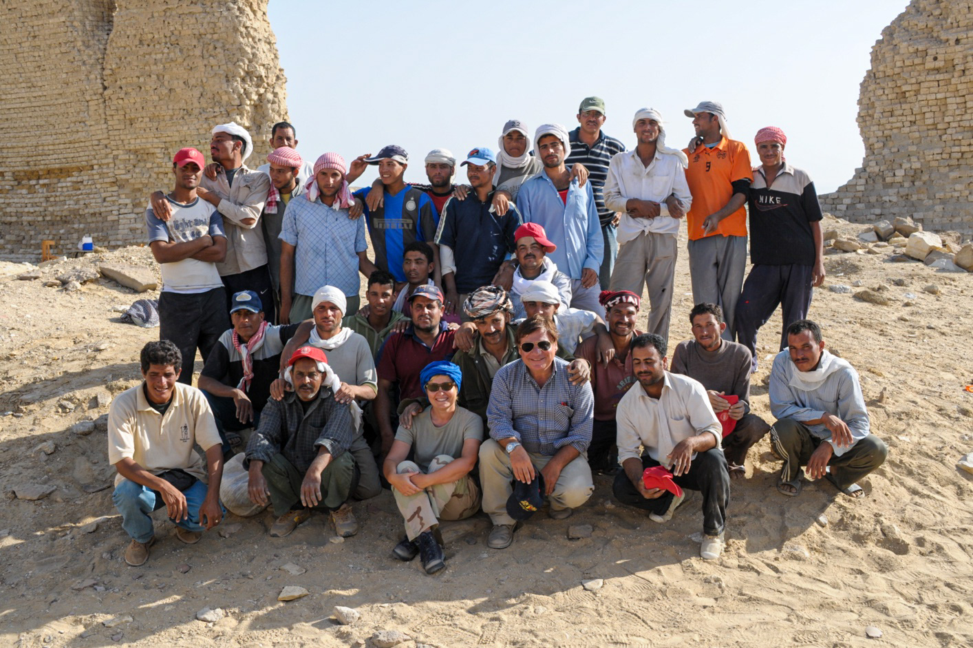
The workmen of the Archaeological Mission with the directors
| Chronology of Ancient Egypt | Years | Dynasties |
|---|---|---|
| Predynastic | 5800-3100 BC | |
| Early Dynastic Period | 3100-2686 BC | I-II |
| Old Kingdom | 2686-2181 BC | III-VI |
| First Intermediate Period | 2181-2055 BC | VII-X |
| Middle Kingdom | 2055-1725 BC | XI-XIII |
| Second Intermediate Period | 1750-1550 BC | XIV-XVII |
| New Kingdom | 1550-1069 BC | XVIII-XX |
| Third Intermediate Period | 1069-747 BC | XXI-XXIV |
| Late Period | 47-343 BC | XXV-XXX |
| Second Persian Period | 343-332 BC | |
| Ptolemaic Period | 332-31 BC | |
| Roman Period | 30 BC-305 AD | |
| Byzantine Period | 306-639 AD | |
| Arab Conquest | 639/641 |
Texts: Paola Davoli
Photos: Bruno Bazzani
3D modelling: Massimo Limoncelli
With a contribution from AEF-ARCE